Central NT – West MacDonnell Range
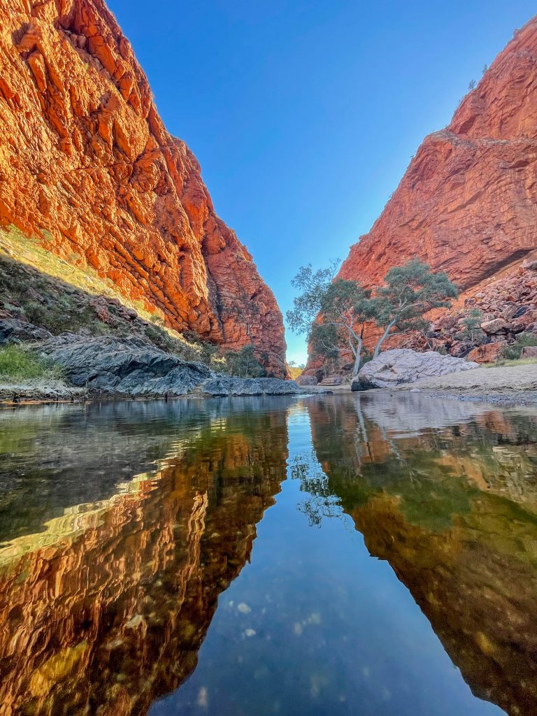
Simpsons Gap
West MacDonnell National Park
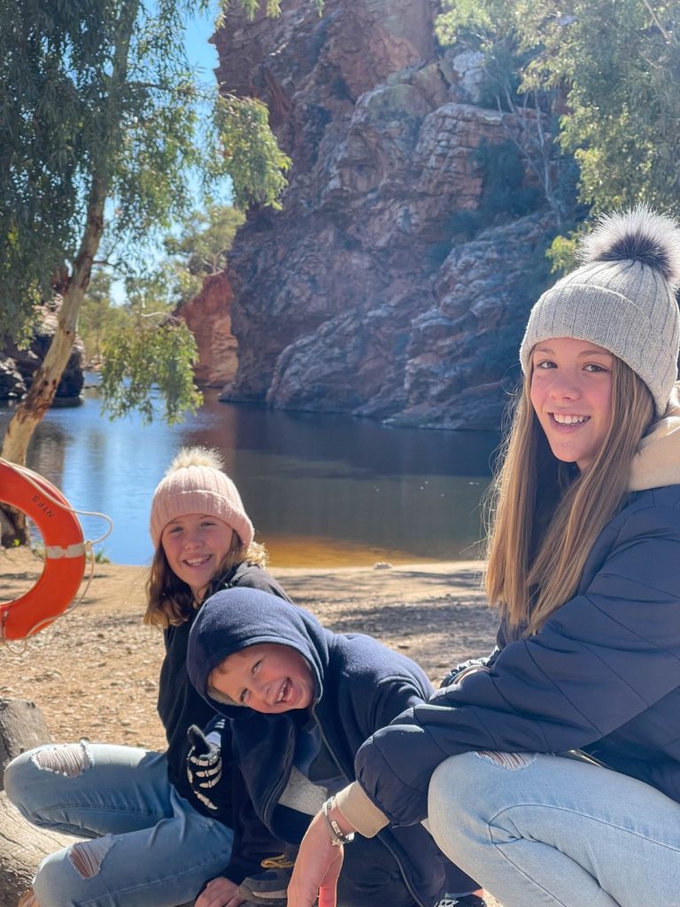
Simpsons Gap is one of the gaps in the West MacDonnell Ranges in Australia’s Northern Territory. It is located 18 kilometres west from Alice Springs, on the Larapinta Trail. The gap is home to various plants and wildlife, including the black-footed rock-wallaby. It is the site of a permanent waterhole.
Click here to view the image Gallery of Simpsons Gap
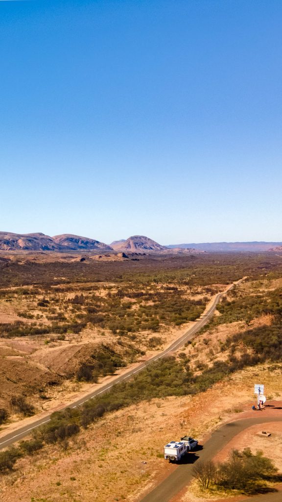
Neil Hargrave Lookout
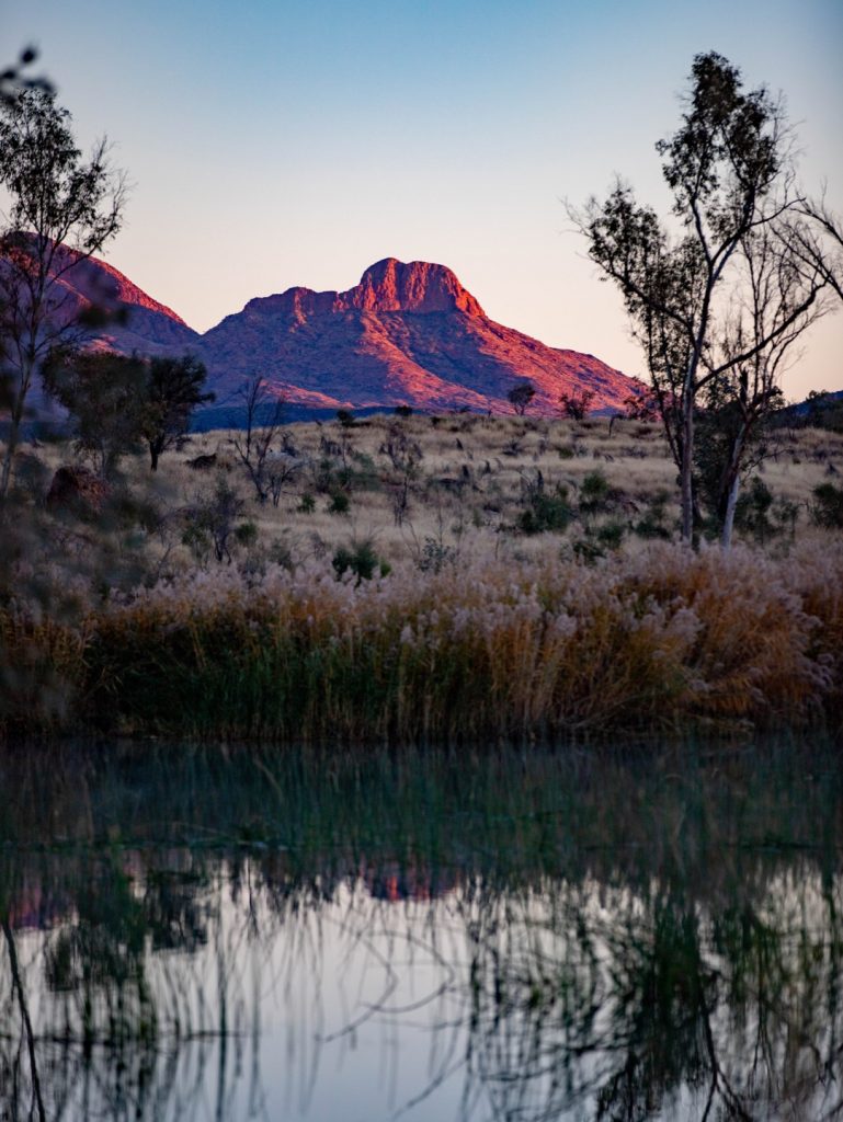
West MacDonnell Range
A 48hr rest stop with no amenities. Stunning views. Located just off the main road about 20km before Glen Helen and just before the Ochre Pits turnoff. It is paved to the top where an extensive panoramic view of the West Macs can be seen. This has some of the only rubbish bins throughout the area. Rest Area off the Namatjira Drive at Burt Plain that offers a shelter with a picnic table and bins. Water tank supply is not treated, before drinking treat the water by boiling it for 5 – 10 mins. There are no toilets. Campers need to be self-sufficient. Dispose of rubbish and toilet paper correctly. If the bins are full take all rubbish with you. Leave no trace. Rest areas are a place where you can stop and rest, making your journey safer and more enjoyable. There are 3 different rest areas available to help you manage your fatigue: *Motorist rest areas—for general and recreational vehicles (including caravans and motorhomes) only *Heavy vehicle rest areas—exclusively for heavy vehicles only *Combined motorist and heavy vehicle rest areas—where there are designated areas for trucks, and general and recreational vehicles. General and recreational vehicles can stop at a rest area for up to 24 hours unless signed otherwise, but they are not camping sites or an accommodation option. It is important motorists use rest areas designated for the type of vehicle they are driving. Check with the authority responsible for the relevant rest area for more information. Truck drivers need to be able to rest in the heavy vehicle rest areas – they should not be used by other motorists, or to stop and camp. Fines may apply if you are not driving a commercial or heavy vehicle and you are found using a heavy vehicle rest area. These fines are in place to make sure truck drivers get to take their legislated rest breaks when using Queensland roads.
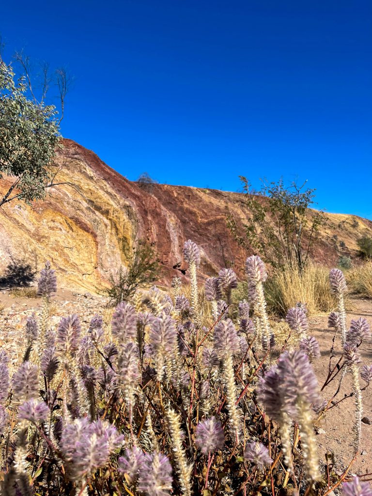
Ochre Pits
West MacDonnell National Park
Head out into the West MacDonnell Ranges to see the vivid colours of the mineral Ochre Pits, which have been mined for generations by the local Aboriginal people. Located 110km west of Alice Springs, the pits are a colourful outcrop of ochre on the banks of a sandy creek. An information shelter at the site provides information about how, why and when the Ochre Pits were used. After browsing this historic site, sit down in the scenic surrounds and enjoy a barbecue lunch. Ochre occurs in a range of earthy colours ranging from white, yellow, orange, red and browns. It’s an important part of Aboriginal culture and is used in everyday life. It’s the raw material for paintings and ceremonial body decoration. Weapons were painted with ochre to increase the success of hunting and to protect the wooden weapons from termites. Red ochre was mixed into an ointment to relieve decongestion, and white ochre used as a magical charm. Opening times Open daily, 24 hours. Entry cost Free entry Facilities Barbeque Carpark Picnic Area Public Toilet Activities Walks Accessibility Disabled access available, contact operator for details.
Ormiston Gorge
West MacDonnell National Park
Ormiston Gorge is a great place for a swim, or to see the towering walls of the gorge and pound, local plants and wildlife. Located 135km west of Alice Springs in the Tjoritja / West MacDonnell National Park, it is accessible by sealed roads and is the trailhead for sections nine and 10 of the Larapinta Trail. The gorge has a waterhole that is there year round and is great for swimming, especially in warmer months. It is located just 500m from the visitor centre and is estimated to be up to 14m deep at its southern end. The five minute Waterhole Walk, which has wheelchair access to the end of the paved path, and the 20 minute one way Ghost Gum Lookout Walk are the most popular with visitors. Another way to explore the area is by walking the Ormiston Pound Walk, which is a three to four hour circuit that follows the rocky slope into the flat expanse of the pound and back along the gorge by the main waterhole. The area has an interesting range of native plants and animals including a number of relict plant species from Central Australia’s tropical past. The park is also an important fauna refuge, with the rediscovery of the Central rock-rat in 1997. You can camp in the designated campsite, though fees do apply.
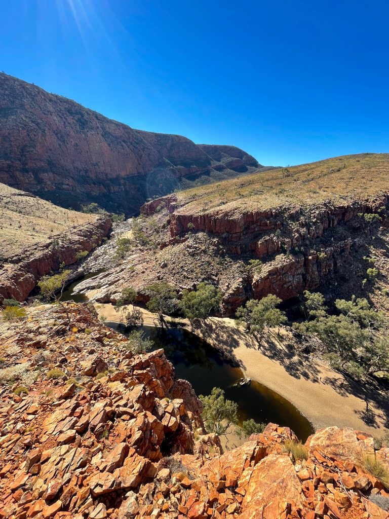
Ellery Creek Big Hole – Campground
West MacDonnell National Park
The spectacular waterhole is fed by the West MacDonnell Ranges (Tjoritja) and surrounded by tall red cliffs and the sandy Ellery Creek. It is also at the trailhead for Sections 6 and 7 of the 231 kilometre Larapinta Trail walk. Thousands of years of massive floods have carved out this waterhole, which is recognised as an internationally significant geological site. Take the 3 kilometre Dolomite walk to see the surrounding formations. The Aboriginal name for Ellery Big Hole is Udepata. The permanent water made it a special meeting place for the Aranda people on the fish and honey ant dreaming trails.
Finke 2 Mile Camp
Amazing River front Camp
While we chilled out for a couple of days it is also an amazing place to base your self to explore the surrounding locations such as Ormiston Gorge, Redbank Gorge and Ochre Pits I’ve added these locations below.
Information on the Camp
The Finke 2 Mile campground sits on the Finke River, near the Mt Sonder Lookout in the Tjoritja / West MacDonnell National Park, around 130 kilometres west of Alice Springs. The campground is accessible by 4WD only. Campers need to be fully self sufficient, as no facilities are provided. Finke 2 Mile is an ideal spot for 4 wheel drivers to base themselves to escape the busier campgrounds and explore the West MacDonnell Ranges. The campground also provides access to Section 11 of the Larapinta Trail.